12. Agricultural Land Anchors Early Towns
What’s growing here? Wheat
Not long after Europeans arrived in New Jersey, they linked their agricultural enterprises to New Jersey’s many waterways, constructing water-powered mills to refine wheat, corn, and other cereals grown on the colony’s farms.
In 1714, Thomas Potts built a grist mill just across the Stony Brook from here, processing grain from neighboring Quaker farms. It was the first mill in the area to exist outside of Trenton. Two years later, Joseph Worth purchased the mill, which his family operated until the late nineteenth century. By 1762, at least four more mills served the Princeton area’s agricultural economy.
These mills, dotting the largely rural New Jersey landscape, shepherded the development of villages, anchoring growing networks of bridges and roads, including a bridge built for Worth’s Mill in 1738. Farmers’ carts carved out transport arteries to the mill, widening forest horse tracks into roads passable for larger vehicles like stagecoaches, which could now traverse Princeton on the journey from Trenton to New Brunswick.
Indeed, transportation to market was essential for farmers, further altering New Jersey’s landscape. The construction of the Delaware & Raritan Canal in the 1830s shortened the journey of agricultural products from Princeton to New York City markets from two weeks to a few days.
Agriculture and its associated industries defined the infrastructure and town development of early New Jersey; processing and transporting crops required the development of reliable roads, bridges, canals, and railroads. This pattern continues today, with Princeton’s new leading business influencers, such as pharmaceutical companies and Princeton University, affecting town planning and land use decisions.
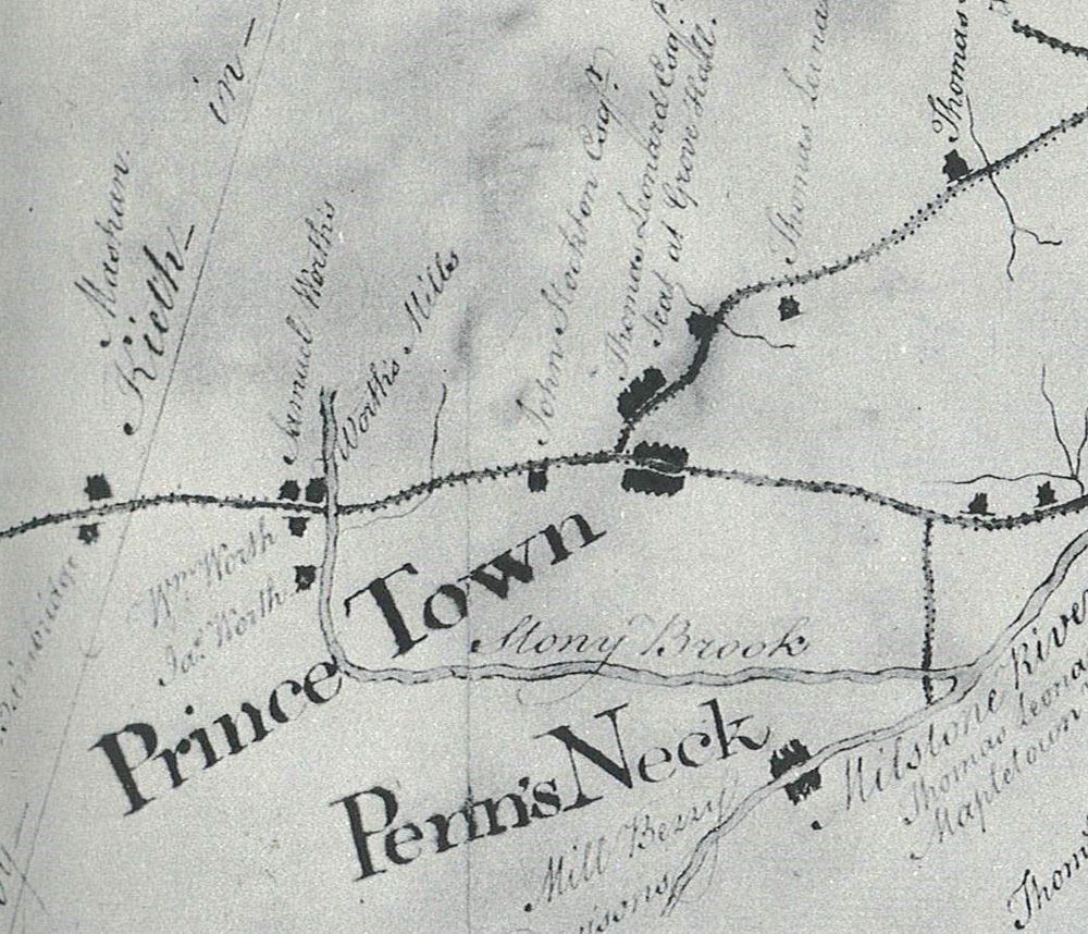
This section of a larger eighteenth-century map shows the roads and bridges leading to and from Worth’s Mill in “Prince Town.”
Detail from “A Map of the Road from Trenton to Amboy, Copied by G. Bancker in 1762 from John Dalley’s Survey of 1745,” New Jersey Road Maps of the 18th Century
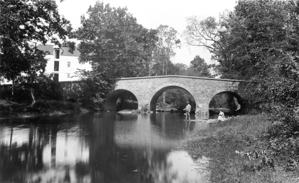
Worth’s Mill and the bridge it inspired are visible in this photograph of two people fishing in the Stony Brook, ca. 1890.
Collection of the Historical Society of Princeton